Tracking Climate and Health in Vermont

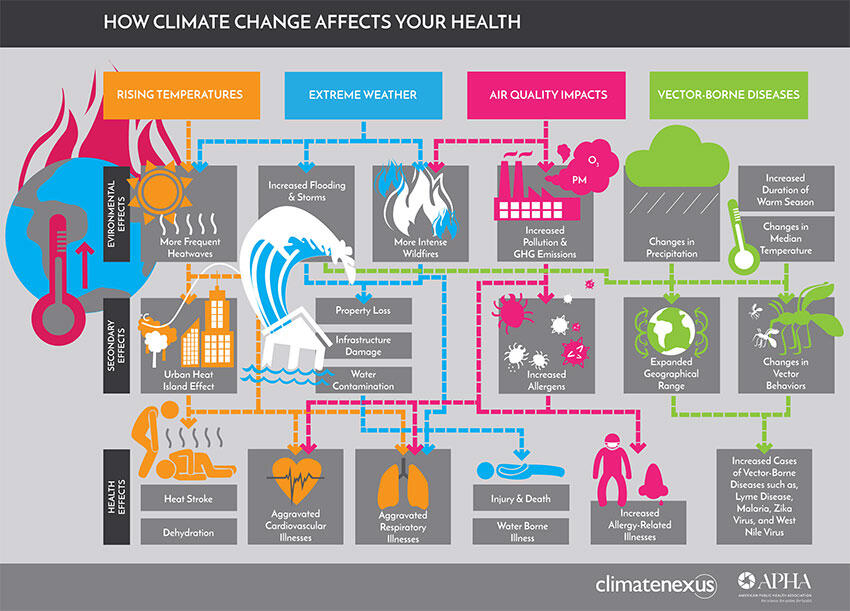
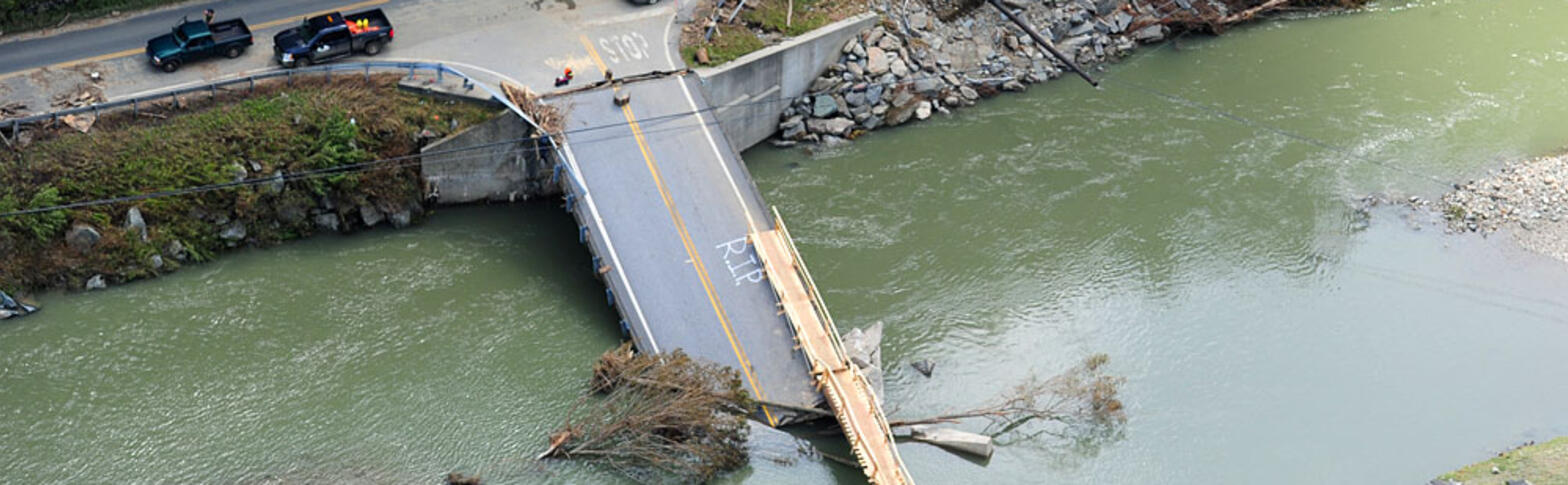
Climate change is already impacting the health of Vermonters. As the state gets warmer and wetter, the impacts on health and property are increasing. The latest National Climate Assessment projects that average temperatures in Vermont will increase by 4°F, compared with recent conditions. In addition, the state will continue to experience more extreme storms.

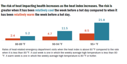
Climate and health data can be used to track the impacts of climate change and to help communities respond. For example, data can be used to identify which parts of the state have higher rates of heat-related illness. This information can inform where cooling centers or other activities aimed at preventing heat-related illness should be located. 

Did you know?

Extreme heat events or heat wavescause more deaths each year in the U.S. than hurricanes, lightning, tornadoes, floods and earthquakes combined.

Explore Climate and Health Data

Heat Data

The reports below are interactive, which means you can:

  • Click on the tabs and buttons to navigate within the reports.
  • Hover over or click on the graphs, tables and maps to learn more.
  • Make the display bigger by clicking the button below.

View in Full Screen
 

Cold Data

The reports below are interactive, which means you can:

  • Click on the tabs and buttons to navigate within the reports.
  • Hover over or click on the graphs, tables and maps to learn more.
  • Make the display bigger by clicking the button below.

View in Full Screen
 

New

The new Impacts of Excessive Heat on Health data brief summarizes the impacts of heat on health in Vermont. While a single hot day can cause heat-related illness, the risk of health impacts grows quickly with multiple hot days in a row. 

Your Questions Answered
Last Updated: